The Maps That Time Forgot
When you bought your home, your lender probably told you whether flood insurance was required based on FEMA flood zone maps. If you were lucky enough to land outside the designated flood zone, you likely breathed a sigh of relief and skipped the extra insurance cost. But here's what nobody mentioned: those maps might have been drawn when your neighborhood was still farmland.
FEMA flood maps across America are operating on borrowed time, with many based on hydrology studies from the 1970s and 1980s. Meanwhile, the landscape they're supposed to represent has been transformed by decades of development that fundamentally altered how water moves across the land.
How Water Moves in Modern America
When engineers originally mapped flood zones, they calculated water flow based on the existing landscape—often rural or lightly developed areas with natural drainage patterns. Trees, grass, and soil absorb enormous amounts of rainfall. Streams meandered through predictable channels, and wetlands acted as natural sponges.
Then came the subdivisions, strip malls, office parks, and parking lots. Every square foot of pavement, roofing, and concrete creates what hydrologists call "impervious surface"—areas where water can't soak into the ground. Instead, it runs off quickly, concentrating into streams and storm drains that were never designed to handle the volume.
A typical suburban development can increase runoff by 200-500% compared to the natural landscape it replaced. That water has to go somewhere, and it often ends up flooding areas that were never considered at risk.
The Development That Changed Everything
Consider what's happened in your area since the 1980s:
- How many shopping centers were built?
- How many subdivisions replaced forests or fields?
- How many roads were widened or added?
- How many parking lots were paved?
Each of these changes affects flood patterns, but FEMA maps update slowly—sometimes taking decades to reflect new realities. The flood zone boundary that determined your insurance requirement might be based on calculations that predate the Walmart, apartment complex, or highway interchange that now sits upstream from your house.
Climate Change Meets Old Math
FEMA maps also rely on historical rainfall data to predict future flooding. They use statistical models based on past storm patterns to estimate "100-year floods" and "500-year floods." But climate scientists have documented significant changes in precipitation patterns across much of the United States.
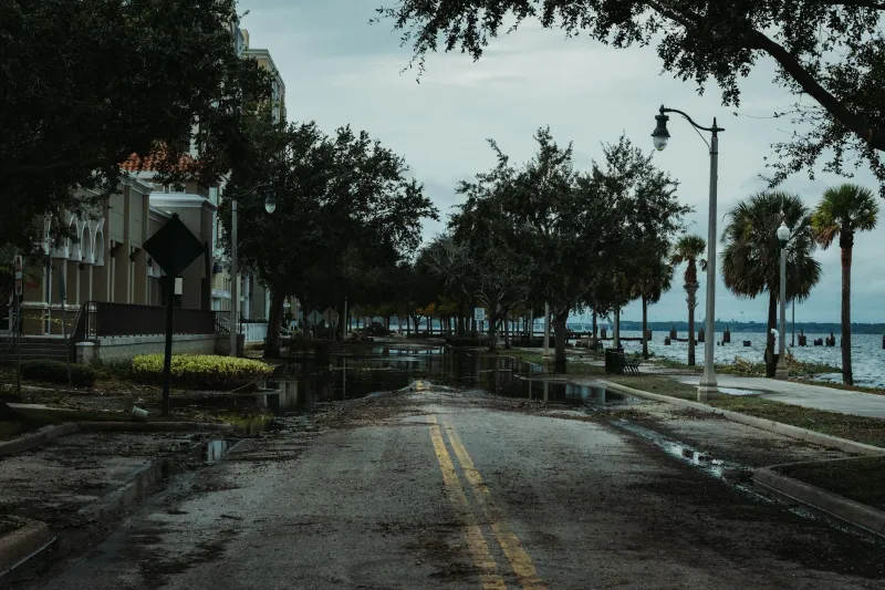
 Photo: United States, via www.thorncroftclematis.co.uk
Many regions now experience more intense rainfall events than the historical data would predict. The "500-year storm" might happen twice in a decade. Meanwhile, FEMA maps continue using calculations based on weather patterns from 30-50 years ago.
The Insurance Industry's Dirty Secret
Here's something insurance companies know but don't advertise: roughly 25% of flood damage occurs outside designated flood zones. Properties in so-called "low-risk" areas flood with alarming regularity, often because the maps haven't caught up with reality.
Worse, homeowners outside flood zones rarely have flood insurance, since it's not required by lenders. When these "safe" properties flood, families face devastating financial losses with no coverage.
Why Maps Stay Outdated
Updating flood maps is expensive and politically complicated. New maps that accurately reflect current flood risk often expand flood zones significantly, which means:
- More homeowners required to buy flood insurance
- Lower property values in newly designated flood zones
- Political pushback from affected communities
- Disputes over development that occurred based on old maps
Local governments and developers often resist map updates that would restrict future development or require expensive infrastructure improvements. The result is a system where everyone knows the maps are wrong, but fixing them creates too many problems.
Reading the Real Landscape
Smart buyers look beyond FEMA maps to assess actual flood risk:
- Drive around after heavy rains to see where water accumulates
- Check with neighbors about flooding history
- Look at topography—water flows downhill, regardless of zone boundaries
- Research what development has occurred upstream
- Consider whether your area has experienced more intense storms recently
The Bottom Line
FEMA flood zones are regulatory tools, not guarantees of safety. They determine insurance requirements and building codes, but they don't necessarily reflect your actual risk of flooding. The "low-risk" designation might be accurate, or it might be based on a landscape that no longer exists.
If you're outside a flood zone, that doesn't mean you're safe from flooding—it means your risk was calculated using old data and old assumptions. Given the relatively low cost of flood insurance for properties outside designated zones, many experts now recommend buying coverage regardless of what the maps say.
Your neighborhood might have changed dramatically since those flood boundaries were drawn. The maps just haven't caught up yet.